
แผนที่ สันป่าข่อย
San Pa Khoi map
“สันป่าข่อย” ย่านที่ไม่เคยหยุดเปลี่ยนแปลง
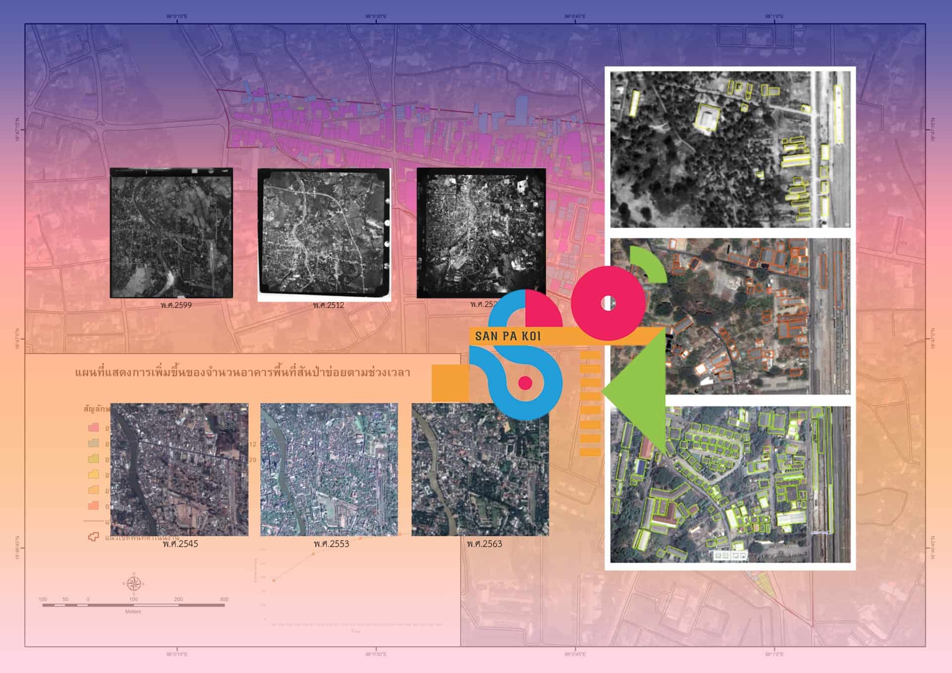
The research team would like to share information on the process of surveying changes in land use and building utilization through the use of such technology through surveying the urbanization changes in the San Pa Koi area. By using aerial photographic survey technology The expert is Mr. Chayakrit Ma-Lampong, an expert behind many urban survey projects.
The basic information to operate the survey of urbanization changes, focusing on changes in the number of buildings and in land use in the San Pa Koi area, uses two parts of data: aerial photographs and high-resolution satellite data. Based on aerial photographs taken in 1956, 1969, and 1986, in terms of basic information from 2002 to the present, in conjunction with the use of the Google Street Map tool, 2011 B.E. 2014 to 2022
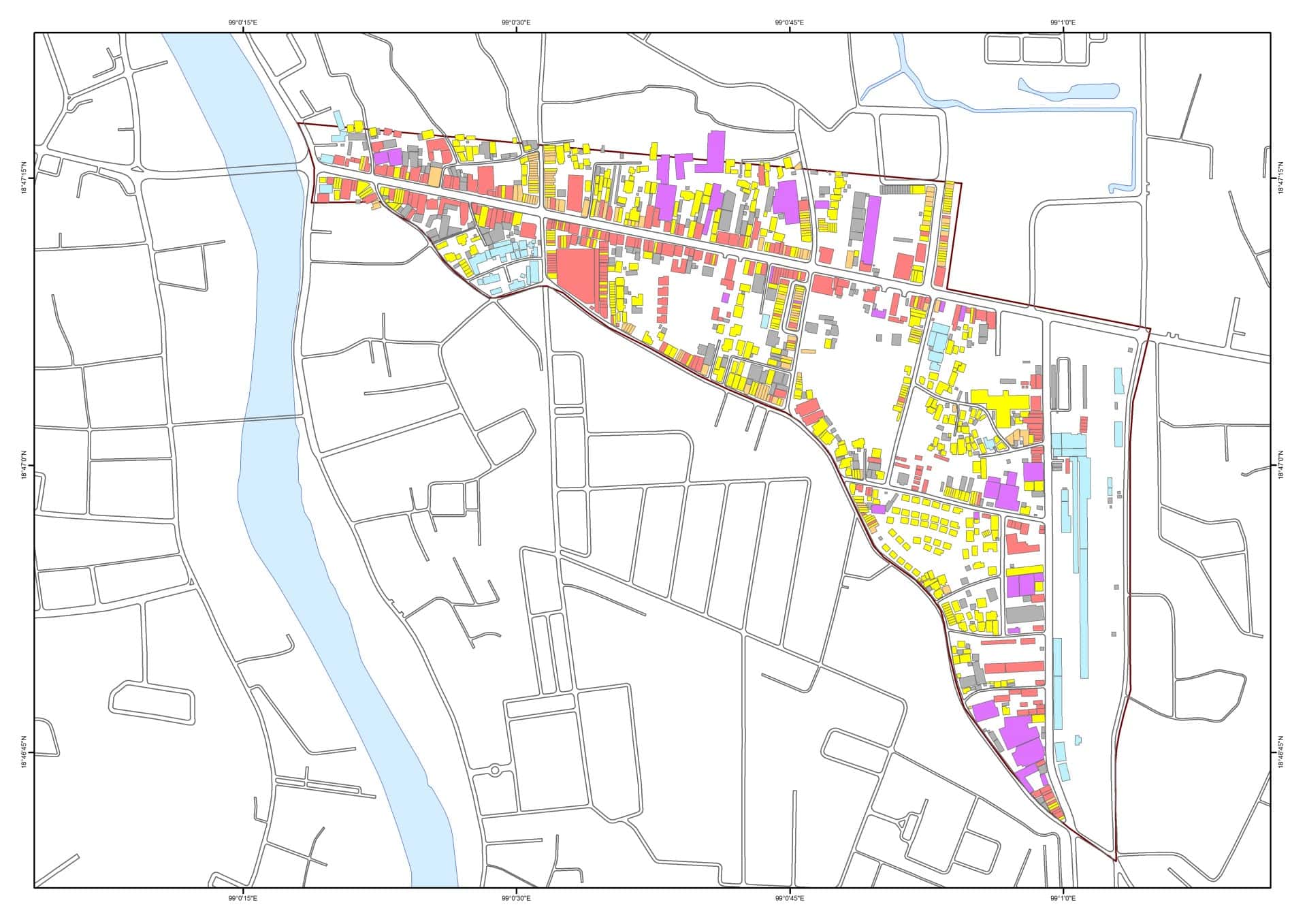
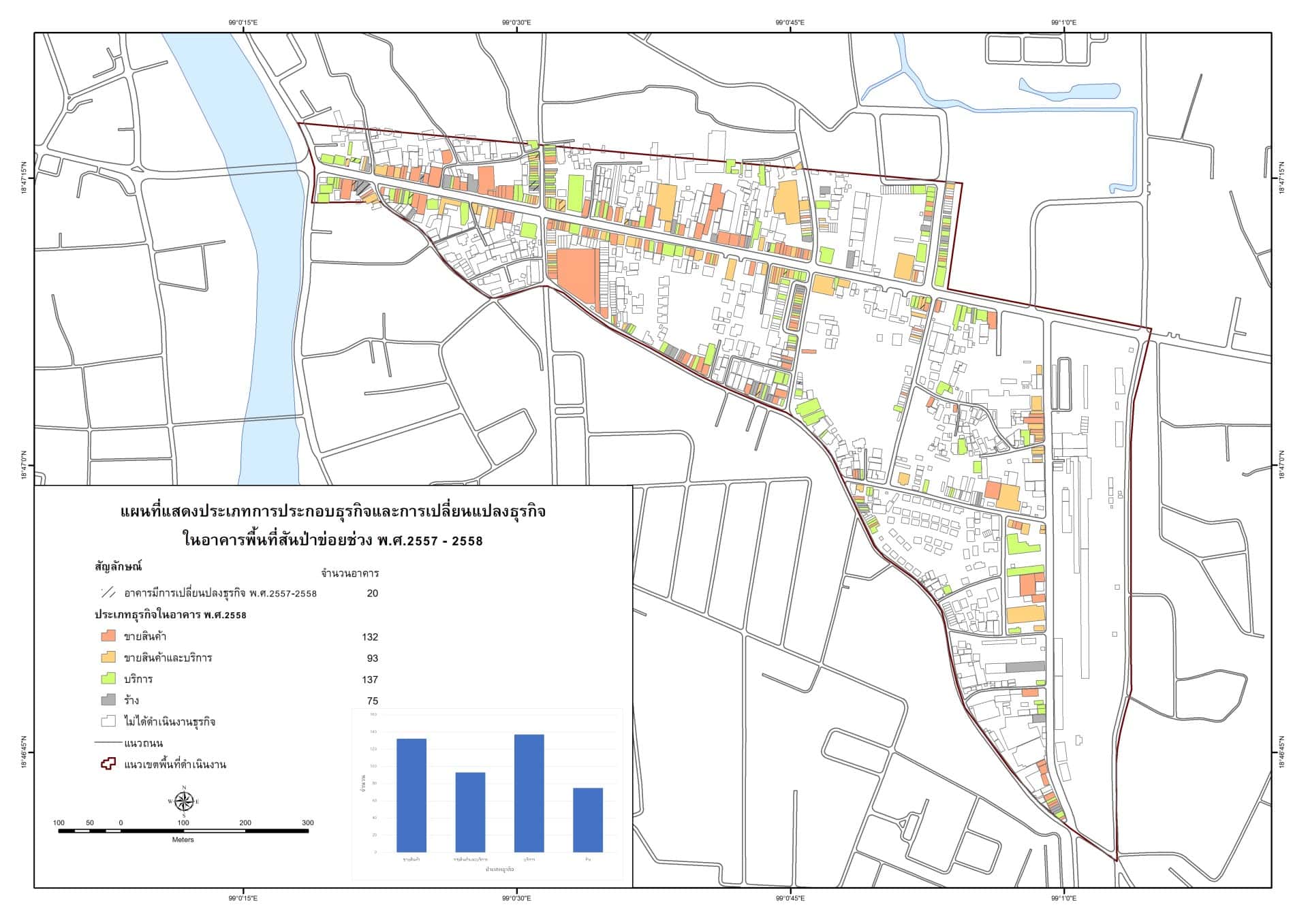
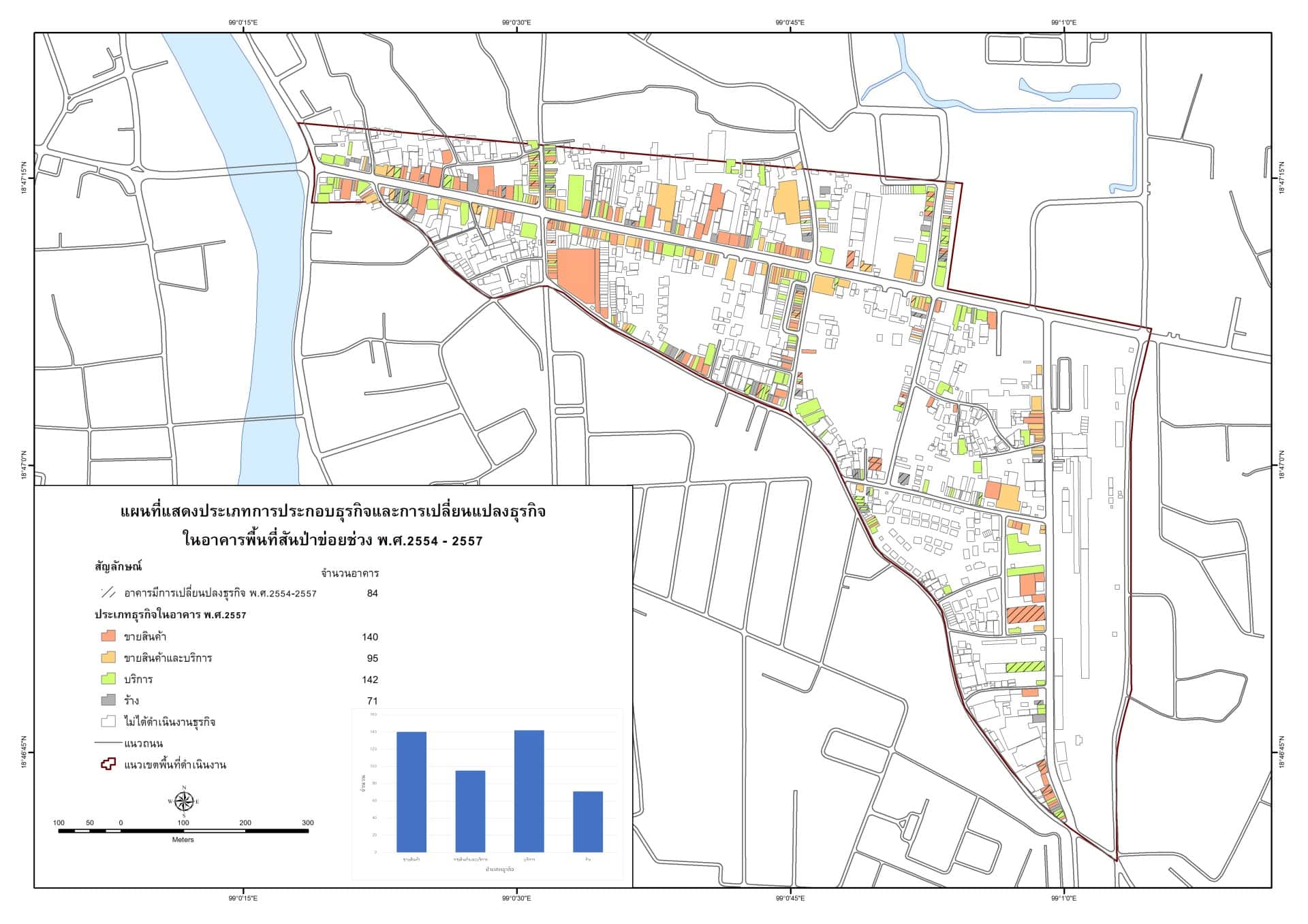
โดยสามมารถสรุปการเปลี่ยนแปลงของจำนวนอาคารในพื้นที่ศึกษาย่านสันป่าข่อยเกิดขึ้นอย่างต่อเนื่องตั้งแต่ปี พ.ศ. 2557 จนถึงปัจจุบัน โดยการเปลี่ยนแปลงประเภทธุรกิจด้านการขายสินค้าและบริการเกิดขึ้นอย่างต่อเนื่องแม้กระทั้งในช่วงโควิดระหว่างปี พ.ศ. 2563 – 2564 ท่านที่สนใจสามารถเข้าไปเดาน์โหลดแผนที่ข้อมูลดังกล่าว “ได้ที่นี้”
หมายเหตุ: ข้อมูลใช้สำหรับประกอบงานวิจัยเท่านั้น โดยหากนำไปอ้างอิงจะต้องระบุรายละเอียดการอ้างอิง คือ โครการบูรณาการทรัพยากรเมืองเพื่อการเรียนรู้และพัฒนาเศรษฐกิจสร้างสรรค์ มหาวิทยาลัยเทคโนโลยีราชมงคลล้านนา เชียงใหม่ เท่านั้น